

![]() NEWS
NEWS
Drone delivery demonstration flight to test disaster response held in three towns and villages in Kiso District, Nagano Prefecture
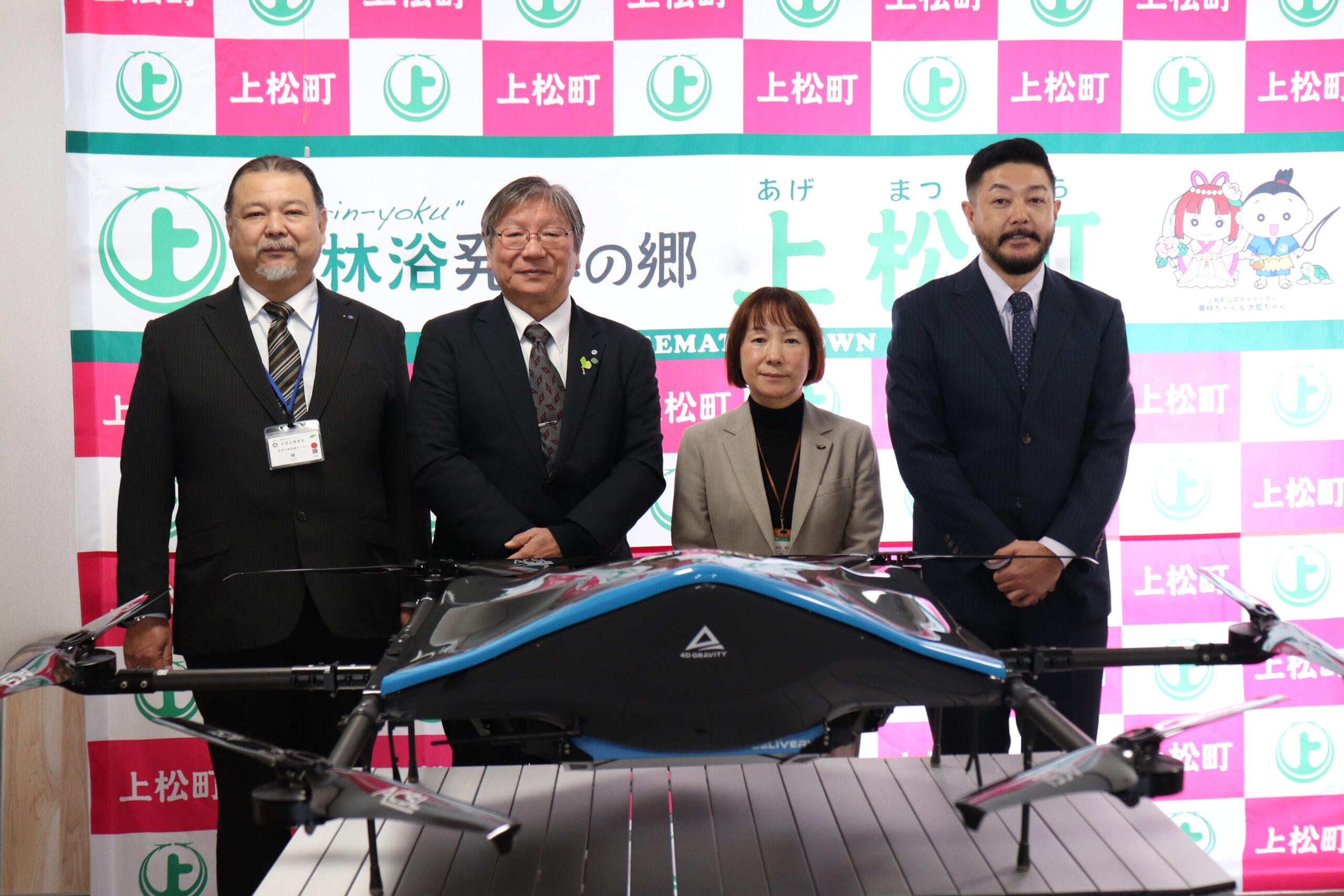
Agematsu Town (Mayor: Makoto Ooya), Okuwa Village (Mayor: Shigeyoshi Sakaya), Nagiso Town (Mayor: Hiroaki Mukai), Kiso Regional Promotion Bureau, Nagano Prefecture (Director: Takashi Watanabe), Kiso Region Union Secretariat (Chair: Kunio Hara), Aeronext Inc. (Shibuya-ku, Tokyo; CEO: Keisuke Toji, hereinafter “Aeronext”), and NEXT DELIVERY Inc. (Kosuge Village, Yamanashi Prefecture; Representative Director: Keisuke Toji; hereinafter “NEXT DELIVERY”) announced that on Tuesday, January 28, 2025, in the Kiso District, the parties performed a demonstration flight of drone delivery in Agematsu Town, Okuwa Village, and Nagiso Town, for the purpose of simulating a disaster response scenario.
In Kiso District, as an initiative to promote the use of drones within the district and to provide rapid support in the event of a disaster, Kiso Town, Agematsu Town, Nagiso Town, Kiso Village, Otaki Village, Okuwa Village, Nagano Prefecture, the Kiso Region Union Secretariat, Aeronext, and NEXT DELIVERY are working together to create drone infrastructure (drone delivery routes and takeoff/landing coordinates) for the six towns and villages in the district.
The inaugural flight was part of a project to prepare for large-scale disasters, and specifically involved delivering disaster relief supplies to areas in Agematsu Town, Okuwa Village and Nagiso Town that could become isolated in the event of a disaster.
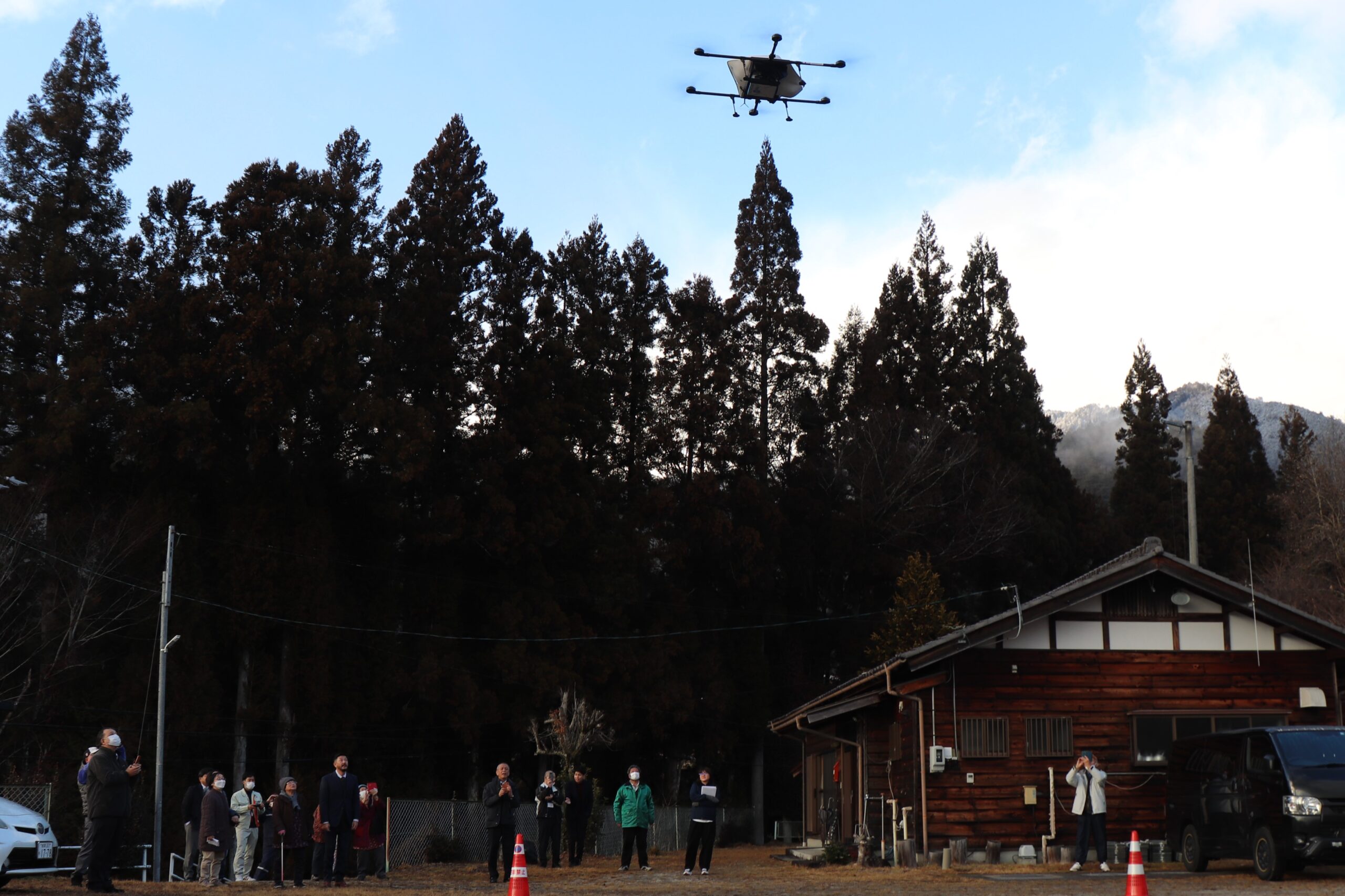
(Ohno Masakane Community Center, Nagiso Town)
【Demonstration Experiment Outline】
1. Background and Purpose
The population of the Kiso District is 23,781 (as of January 1, 2025). Located in the southwestern part of Nagano Prefecture, the area is surrounded by rich forests and mountains, with the beautiful Kiso River at its center. The tributaries of the Kiso River and the spring water from the mountains are used not only for local agriculture and as water for daily life, but also support the surrounding ecosystem. The area is at high risk of natural disasters, and there is a possibility that municipalities in the area could become isolated in the event of an emergency, such as heavy rain, landslides, or earthquakes that block roads. In particular, in mountainous areas, access is often restricted due to geographical factors, and the transportation of emergency supplies and medical support are key issues. In addition, in the Kiso District, as the local population ages, there is a need for new initiatives to build a rapid support system in the event of a disaster and to prevent the isolation of municipalities. In order to respond to these situations, the use of drone technology is attracting attention, and the introduction of drones using DX technology is sought after with the aim of improving the convenience of residents and responding quickly in the event of an emergency.
Against this background, the Kiso District has built a disaster prevention infrastructure that utilizes drones as a system for quickly delivering supplies to isolated areas in the event of a disaster.
2. Implementation Details
A demonstration experiment was conducted to showcase the transport of goods in the event of a disaster to locations expected to become isolated in the event of a disaster. In conjunction with the demonstration experiment, we provided information on the project and explained the drone aircraft, then the 3 routes for the drone delivery demonstration flights were conducted as follows:
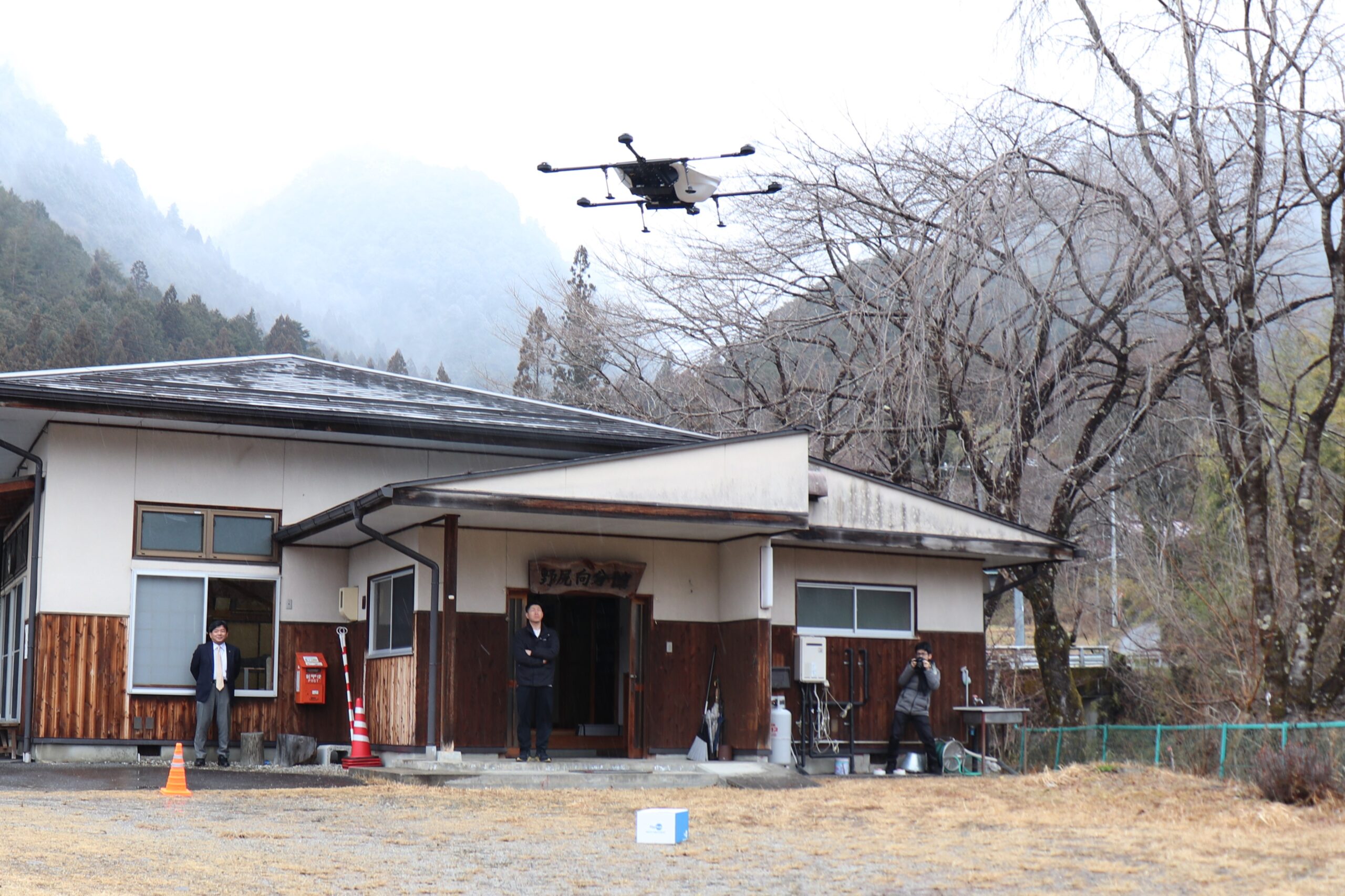
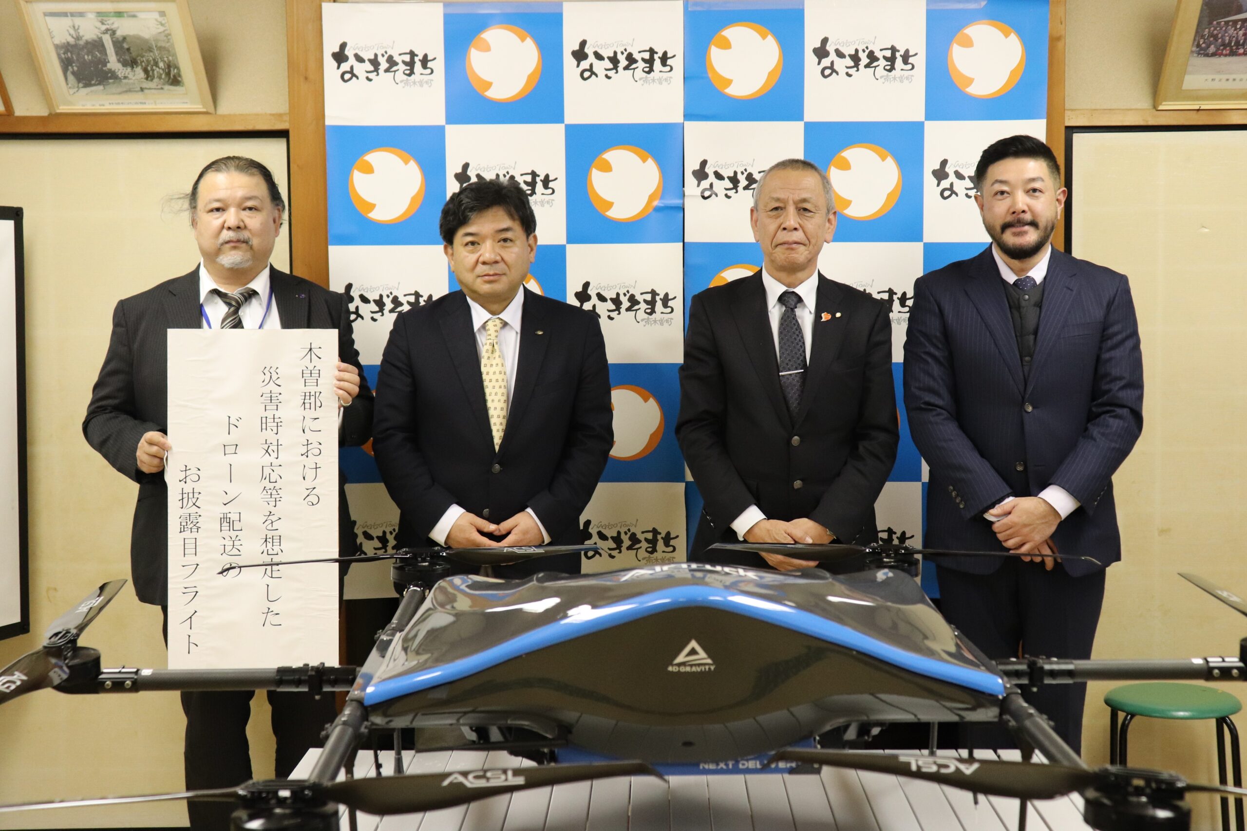
①Agematsu Town: Yoromai Parking Lot⇒ Dana Seikatsukaizen Center / ②Okuwa Village: Okuwa Village Office Parking Lot⇒Nojiri Mukai Annex / ③Nagiso Town: Wajima General Ground⇒Ohno Masakane Community Center ※Total of 3 Routes
【Route1】 We conducted drone deliveries of disaster relief supplies to the Dana Seikatsukaizen Center in Agematsu Town, which is expected to be isolated.
The flight distance is approximately 4.6 km, and it will take about 12 minutes to deliver the supplies.
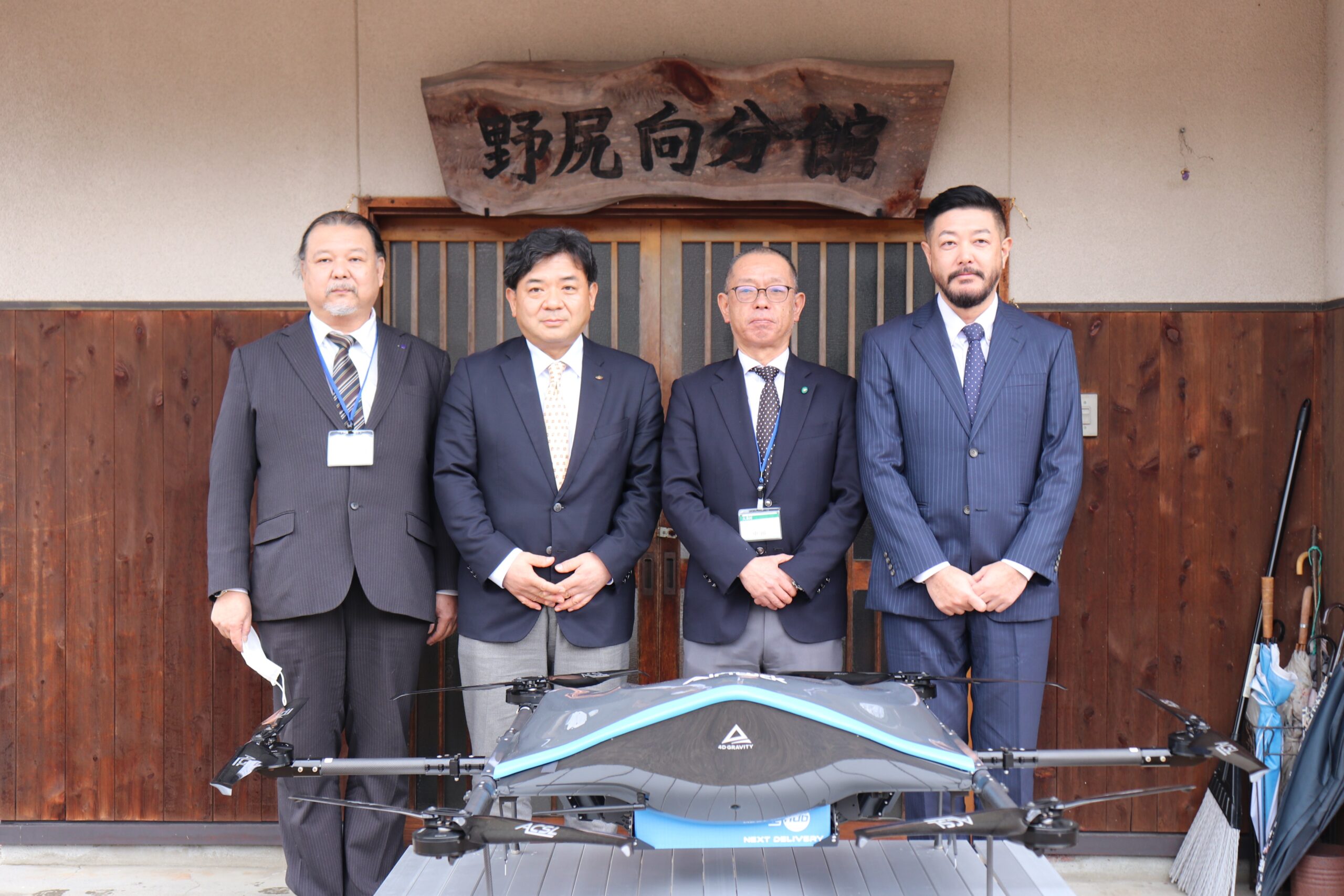
【Route 2】 We conducted drone deliveries of disaster relief supplies to the Nojiri Mukai Annex in Okuwa Village, which is expected to be isolated. The flight distance is approximately 4.1 km, and it will take about 10 minutes to deliver the supplies.
【Route3】 We conducted drone deliveries of disaster relief supplies to the Ohno Masakane Community Center in Nagiso Town, which is expected to be isolated. The flight distance is approximately 6.1 km, and it will take about 15 minutes.
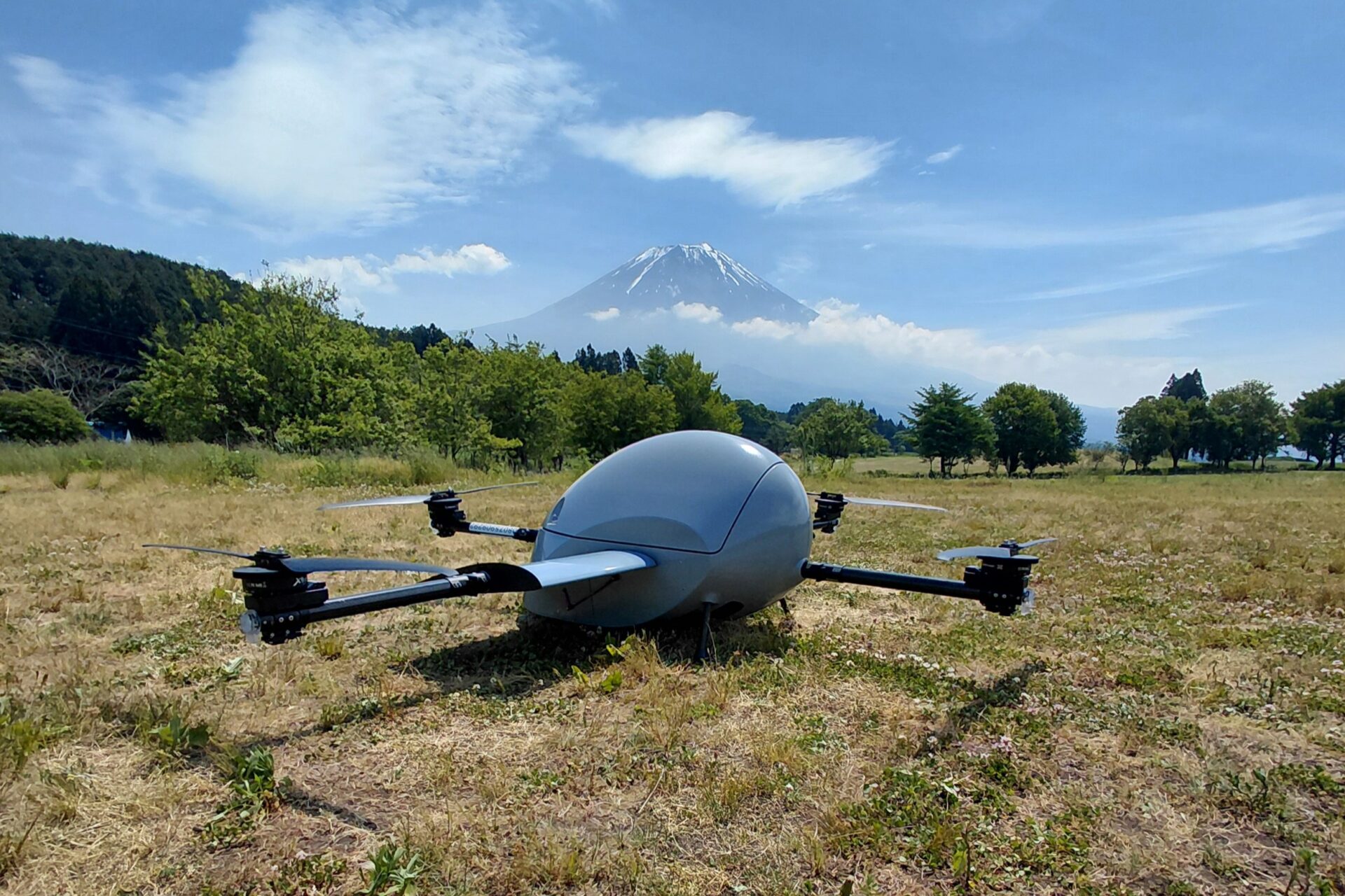
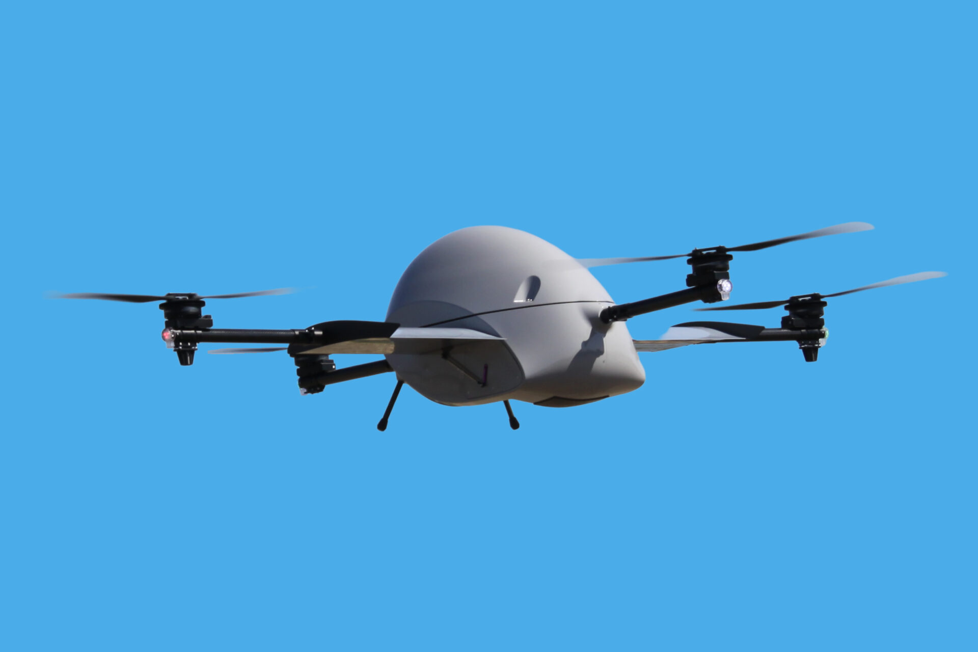
The aircraft used was the AirTruck*1, a logistics-dedicated drone developed by Aeronext.
After the disaster relief supplies were delivered by drone over a distance of approximately 4.6 km in 12 minutes, from Yoromai Parking Lot to Dana Seikatsukaizen Center in Agematsu Town, Ms. Hideko Tanaka, who received the disaster relief supplies by drone, commented, “Excellent. Very easy if you can leave it there. It would be very helpful in case of an emergency.”

(Nojiri Mukai Annex, Okuwa Village)
Going forward, we will continue to expand the development of drone delivery routes and coordinate settings for disaster response, and we will further advance the development and construction of infrastructure for drone delivery, and promote the creation of communities that can respond quickly in the event of a disaster.
※This demonstration experiment has been selected as part of the “2024 Kiso District Disaster Prevention Infrastructure Development Work Contract Using Drones” project.
※Funding for this project comes from the “2024 Nagano Prefecture Community-based Energy Creation Support Fund.”
Reference
*1 Dedicated Logistics Drone AirTruck
AirTruck, the first mass-produced logistics drone developed in Japan by Aeronext, a next-generation drone technology startup, in collaboration with ACSL, achieves stable flight with Aeronext’s proprietary 4D GRAVITY®*2 airframe structure design technology. AirTruck is a dedicated logistics drone that goes “faster, farther, and is more stable” with enhanced logistics, specialized for forward motion, and aerodynamic characteristics required for long-distance flight. AirTruck has flown in demonstration tests in various regions of Japan and has a top-class flight record in Japan and internationally it has flown in Mongolia at an altitude of 1,300m and an outside temperature of -15°C (November 2023).
*2 Airframe structural design technology 4D GRAVITY®
Airframe structure design technology developed by Aeronext optimizes aerodynamic characteristics by equalizing motor speed regardless of attitude, condition, or movement during flight and controlling lift, drag, and fuselage center of gravity based on fuselage shape and structure to improve the basic performance of industrial drones, such as stability, efficiency, and mobility, and the transportation performance of drones dedicated to logistics. Aeronext has patented this technology and manages it as part of the 4D GRAVITY® patent portfolio. 4D GRAVITY® improves basic performance and opens up new markets and applications for industrial drones.
【About Agematsu Town】
Agematsu Town is located in the southwestern part of Nagano Prefecture, almost in the center of Kiso District, and has a long east-west shape, measuring 24.5 km from east to west and 13 km from north to south, with a total area of 168.42
km2. To the east, the Kiso Komagatake (2,956m) is the main peak of the Kiso Mountains, and to the west there are mountains such as Sotoba (1,541m) and Daigamine (1,503m).
The Kiso River runs through the center of the town from north to south, and National Route 19, the Kiso River Right Bank Road, and the JR Chuo Main Line run alongside it. On the left bank of the Kiso River, the rapid currents of the Namegawa, Juozawa and other small and medium-sized rivers, which have their source in Mount Kisokoma, flow into the Kiso River, and on the right bank, streams flow in from the national forest, and all of these rivers have steep terrain. These rivers form a mysterious valley, flow through the forest area of the five Kiso trees, and create a spectacular view.
In addition, 95% of the total area is forest, and 69% of this is national forest. The total area of arable land and residential land is only 3%. This arable land and residential land is mainly concentrated in the areas along the river plateaus and at altitudes of 550m to 1,100m.
Akazawa Natural Recreation Forest, which is famous as the birthplace of forest bathing in Japan, has been certified as a “Forest Therapy Base” for its facilities and areas, and it has been medically proven that forest bathing in Akazawa contributes to relaxation.
*For more information:https://www.town.agematsu.nagano.jp/
【About Okuwa Village】
Okuwa Village, located in the southwestern part of Nagano Prefecture, is a mountain village measuring 30km from east to west and 10km from north to south, with a total area of 234.47 square kilometers.
To the east are the mountains of the Central Alps, including Mount Minamikoma, to the south is Nagiso Town, to the north is Agematsu Town, and to the west is Nakatsugawa City and Otaki Village in Gifu Prefecture.
Terrain is steep, and 96% of the total area of the village is covered in forest.
National Route 19 and the JR Chuo Line run along the Kiso River, which flows from northeast to southwest through the center of the area.
Villages and cultivated land are scattered throughout the basin of the Kiso River and its tributary, the Ina River (elevation 500-800m).
*For more information:https://www.vill.okuwa.lg.jp/
【About Nagiso Town】
Nagiso Town is located in the southwestern part of Nagano Prefecture, at the southern end of the Kiso Valley, on the border with Gifu Prefecture.
The total area is 215.93 km2, and it is a mountainous area 20 km east to west, 15 km north to south, and 70 km in circumference on a narrow terrace formed by the Kiso River and its tributaries, Yogawa, Kakizoregawa, Araragigawa, and Tsubokawa, etc., there are seven villages – Yogawa, Hokubu, Midono, Tsumago, Araragi, Hirose, and Tadachi. Agricultural land scattered along a narrow strip, with the elevation of each village ranging from about 300m to about 950m. In addition, 90% of the town’s area is covered by forest, of which about 70% is national forest.
The JR Chuo Line and National Route 19 run north to south along the Kiso River that flows through the center of town, and National Route 256 runs east to west through the Ina Valley. It is located approximately 20km from the center of the neighboring city of Nakatsugawa, 35km from the neighboring city of Kiso, and 35km from Iida, and has long been a strategic location for transportation connecting the Ina and Kiso valleys.
The area has many steep slopes and few flat surfaces. The climate is mild but the rainfall is high, with annual precipitation reaching 2,500 to 3,000 mm in some years. This topography and climate have led to numerous debris flow disasters in the past, but they have also nurtured rich forest resources, and the town has long relied on timber production and woodworking as a core industry. The town’s main industry is tourism, which includes the Tsumago-juku area, which has been designated as an Important Preservation District for Groups of Historic Buildings by the national government, and the Momosuke Bridge, which has been designated as a modern heritage site by the national government.
*For more information: https://www.town.nagiso.nagano.jp/
【About Kiso Region Union Secretariat】
A special public organization in the Kiso region of Nagano Prefecture responsible for 31 wide-area administrative tasks, including long-term care insurance, firefighting, the environment, regional development, forest management, cultural education, and cable television, in accordance with its charter.
*For more information: https://www.kisoji.com/
【About Kiso Regional Promotion Bureau, Nagano Prefecture】
The Kiso Regional Promotion Bureau is a local organization established by Nagano Prefecture. It is an organization that accurately identifies the issues and needs arising in the Kiso region, which is made up of six towns and villages (Kiso Town, Agematsu Town, Nagiso Town, Kiso Village, Otaki Village, and Okuwa Village), and works proactively and independently to address regional issues in a timely manner in collaboration with related organizations.
*For more information: https://www.pref.nagano.lg.jp/kisochi/somu-kankyo/
【About Aeronext Inc.】
Aeronext is a research and development technology startup that has a vision of “new economization of airspace,” Aeronext develops and patents industrial drone technologies and conducts licensing in order to create a world where the sky becomes societal infrastructure and economized, and social issues are resolved with drones. Our core technology is 4D GRAVITY®︎, a unique structural design technology that improves basic drone performance such as stability, efficiency, and mobility of industrial drones by optimizing the center of gravity of the aircraft. In order implement this 4D GRAVITY®︎ as standard equipment on industrial drones, we have constructed a strong patent portfolio and are promoting a partnership-based platform business for the 4D GRAVITY®︎ license globally.
Aeronext has also founded NEXT DELIVERY, to enable new smart logistics SkyHub®︎ utilizing drones and are proactively working on the societal implementation of drone delivery services and commercialization of those services.
*For more information: https://aeronext.com/about/company/
【About NEXT DELIVERY Inc.】
A strategic subsidiary of Aeronext, whose main business is drone delivery, established in Kosuge Village, Yamanashi Prefecture in 2021 based on the Aeronext Group’s mission, “A new societal infrastructure for the 100-year life era, a world where enrichment is spread to every corner of the world.” Aeronext and Seino HD jointly develop and deploy SkyHub®, a new smart logistics system that connects existing logistics and drone logistics to create a new societal infrastructure. We are also developing related businesses such as development, sales, operation, and maintenance of both hardware and software related to integrated delivery and drone delivery. Starting with Kosuge Village, Yamanashi Prefecture, we are working to improve the efficiency of regional logistics and address regional issues throughout Japan, including Kamishihoro Town, Hokkaido, and Tsuruga City, Fukui Prefecture.
*For more information: https://aeronext.com/about/company/
*Aeronext, the Aeronext logo, and NEXT DELIVERY, as well as “4D GRAVITY®︎” “SkyHub®“ are trademarks of Aeronext Inc.
*Other company names and product/service names mentioned in this press release are registered trademarks or trademarks of their respective owners.
Related article
-
Aeronext to Unveil New Japanese-Made Logistics D...
Learn more
-
NEXT DELIVERY to Exhibit at “Transport Safety & ...
Learn more
-
Aeronext Showcases “IP × Technology” Vision at S...
Learn more
-
Aeronext Unveils Prototype Logistics Drone Equip...
Learn more
-
Aeronext Completes 422 Drone Blood Deliveries Ov...
Learn more
-
Aeronext Enters into Contract with JAXA for Deve...
Learn more